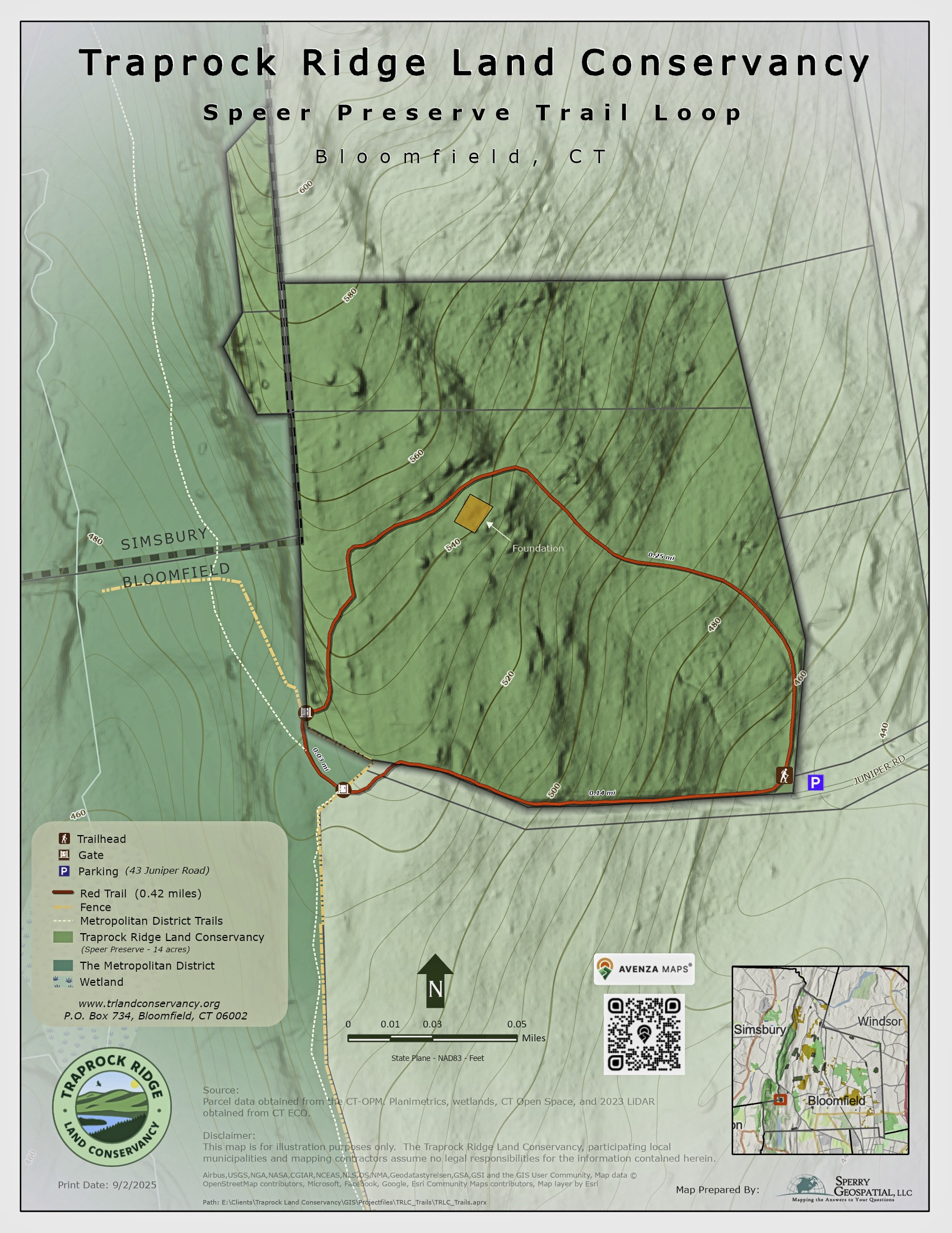
Speer Preserve Trail
Rating/Terrain: Moderate/sloping terrain
Distance: 0.42-mile loop
Parking: At the end of Juniper Road
Trail Access: At the end of Juniper Road off Route 185 (Simsbury Road)
Feature: Views, old stone fireplaces and remnants of a homestead
Location
The trailhead can be found at the end of Juniper Road. Going counterclockwise on this loop, this trail will connect to the MDC trail system, the Metacomet trail and the Talcott Ridge trails on the right. You will also find signage for Heublein Tower (approx. 1 mile from the Speer property corner).
Description
This short loop is rich with diversity, with an upland hardwood forest strewn with boulders, old stone fireplaces and remnants of a homestead. Along the gas line trail westward beyond a cliff edge are stunning views, especially in winter. Proceeding onto the MDC trails, enjoy views of the rock cliff that forms the Simsbury/Bloomfield line. Continue on to the Talcott Ridge trail for spectacular panoramic views. These trails provide three-season hiking and memorable cross-country skiing.
History
The 14 total acres of secluded woodland were donated in March 1994 and December 2009 by The Nature Conservancy and Edmund and Elizabeth Speer.